Route 66 remains the most storied road trip in the United States, and planning a full 2026 drive requires more than nostalgia. Travelers need a practical Route 66 planning guide that explains the original alignment, modern drivable sections, timing, budgeting, lodging, navigation, safety, and the side trips that turn a long drive into a memorable cross-country journey. Often called the Main Street of America, Route 66 originally ran about 2,448 miles from Chicago, Illinois, to Santa Monica, California, crossing eight states and hundreds of towns. It was officially decommissioned in 1985, yet large portions survive as state roads, business loops, frontage roads, and signed historic byways. That distinction matters because a successful trip is not simply entering an address and following one highway; it is a stitched route that mixes old pavement, parallel interstates, city streets, and preserved landmarks.
I have planned Route 66 itineraries for first-time visitors, families, retirees traveling slowly in RVs, and drivers trying to complete the route in one intense week. The biggest mistake I see is treating Route 66 like a single uninterrupted road. The second is underestimating how much time small-town stops, museums, photo pulls, and classic diners actually take. In 2026, those details matter even more because infrastructure updates, seasonal construction, wildfire-related detours in the Southwest, and changing business hours can alter the daily plan. A hub article should therefore answer the core questions first: how long Route 66 takes, where to stop, when to go, how much it costs, and what tools help you stay on the historic path. Once those fundamentals are clear, the route becomes manageable and far more rewarding.
What Route 66 Is and How to Plan the Route in 2026
Route 66 is best understood as a historic corridor rather than a continuously signed highway. In practical terms, your Route 66 road trip combines surviving original segments with nearby roads that reconnect the chain. Most travelers drive east to west, beginning in Chicago and ending at the Santa Monica Pier, because that direction follows the route’s cultural mythology and usually places the sun at your back for many daytime stretches. Westbound driving also builds naturally from Midwestern cityscapes to open plains, red-rock desert, and the Pacific Ocean, giving the trip a strong narrative arc.
For 2026 planning, start with three decisions: trip length, travel style, and route fidelity. A seven-to-nine-day trip can cover the full corridor, but it demands long driving days and selective stops. A ten-to-fourteen-day itinerary is the sweet spot for most people because it allows major landmarks, classic motels, and a few detours without constant rushing. Two to three weeks is ideal if you want museums, hikes, neon photography, and meaningful time in small towns. Route fidelity means deciding whether you want the most authentic alignment possible or a balanced trip that uses interstates when needed. Purists may seek original pavement in Illinois, Missouri, Oklahoma, Texas, and Arizona, while families often prefer faster interstate segments between major attractions.
Navigation requires layering tools. Google Maps is useful for live traffic and business hours, but it will not preserve the historic route by itself. I recommend pairing it with the EZ66 Guide for Travelers by Jerry McClanahan, state Route 66 association maps, and offline maps in a dedicated app such as Gaia GPS or Google Maps downloads. This combination reduces missed turns in urban sections like Chicago, St. Louis, Albuquerque, and Los Angeles. If you are creating a hub for route guides, your related planning resources should break out state-by-state overviews, daily itinerary templates, and themed guides for diners, motels, museums, and photo stops.
Best Time to Drive Route 66
The best time to drive Route 66 is typically late April through early June and mid-September through late October. These windows offer moderate temperatures across most of the route, longer daylight hours, and fewer weather extremes than midsummer or winter. Spring brings green landscapes in the Midwest and often comfortable conditions in Arizona and New Mexico. Fall usually offers stable driving weather, lighter family-travel crowds, and excellent light for roadside photography. If your schedule is flexible, target May or late September for the strongest balance of comfort and business availability.
Summer is the most popular season, but it comes with tradeoffs. Temperatures in Texas, New Mexico, Arizona, and inland California regularly exceed 100 degrees Fahrenheit, which affects both people and vehicles. Cooling systems, tire pressure, and hydration become real safety concerns, especially on long stretches between services. Summer also means school-break traffic, higher room rates in some gateway destinations, and crowded icon stops such as Cadillac Ranch, the Blue Whale of Catoosa, and Santa Monica. Winter travel is possible, but snow, ice, and wind can disrupt sections in Illinois, Missouri, and the high country around Flagstaff. Some vintage motels, seasonal roadside attractions, and small-town cafes also reduce hours or close entirely in the off-season.
Weather planning should be state specific. Illinois and Missouri can see spring storms and flash flooding. Oklahoma and Texas sit in severe weather territory during tornado season. New Mexico’s elevation creates cool nights even after warm days. Northern Arizona adds mountain weather, especially around Flagstaff, where temperatures can be dramatically lower than in lower-elevation desert stops. California introduces major metro traffic rather than severe climate as the dominant planning challenge. Before departure, check National Weather Service forecasts, state department of transportation advisories, and local fire restrictions in the Southwest. Those sources are more reliable than a generic weather app when conditions shift quickly.
State-by-State Route 66 Highlights and Anchor Stops
Each of the eight Route 66 states has a distinct character, and understanding those differences helps you choose where to spend extra time. Illinois introduces the story with urban architecture in Chicago, preserved diners, and giant roadside figures in towns such as Wilmington. Missouri adds river crossings, Meramec Caverns, and classic neon in places like Cuba and Springfield. Kansas contributes only a short segment, but its brief stretch is rich in charm, with Galena and Riverton offering restored service stations and easy photo stops. Oklahoma is one of the strongest states for drivable historic alignment, independent museums, and evocative small towns including Clinton, El Reno, and Tulsa.
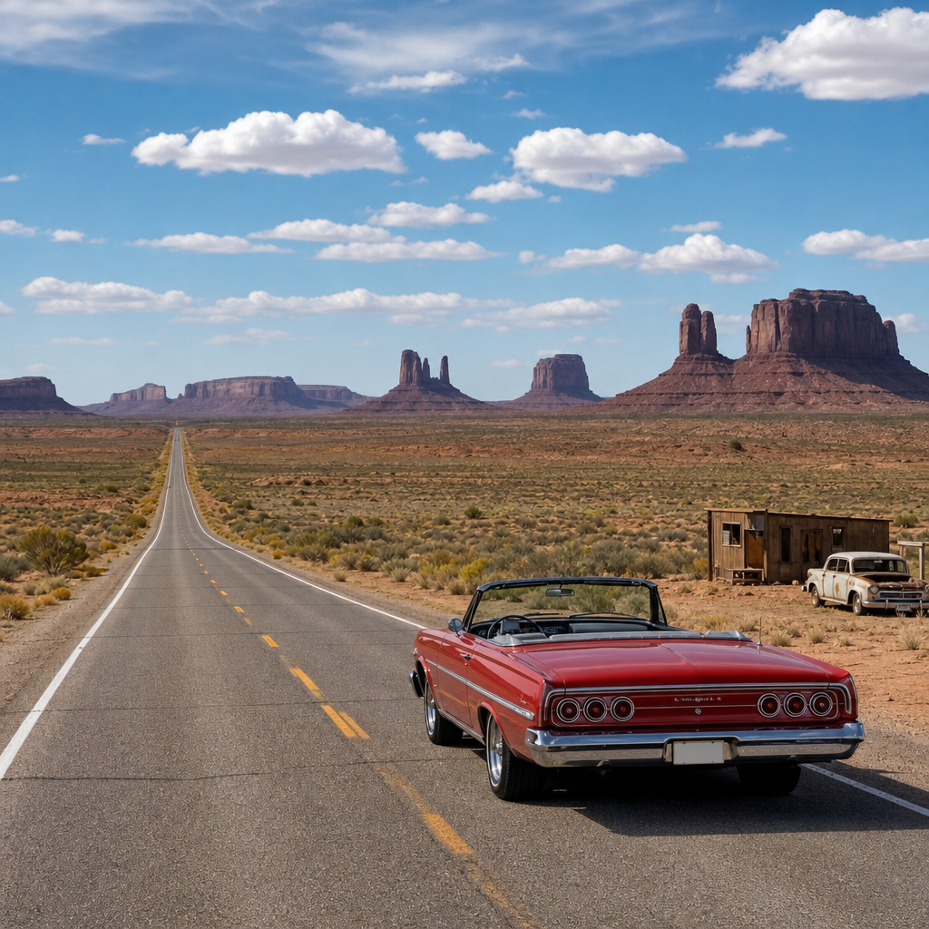
Texas condenses the Panhandle into a memorable run of bold roadside Americana: Shamrock’s Conoco Tower Station, Amarillo’s Cadillac Ranch, and the Big Texan define the state’s playful scale. New Mexico shifts the mood with adobe architecture, high desert scenery, and a route history that includes both the earlier Santa Fe alignment and the later direct line through Albuquerque. Arizona is, for many drivers, the emotional center of the trip because it preserves long drivable stretches, standout vintage towns like Seligman and Williams, and major natural detours including Petrified Forest National Park and the Grand Canyon. California closes the journey with Mojave Desert landscapes, quirky survivors such as Roy’s Motel and Cafe in Amboy, and the final urban push through greater Los Angeles to Santa Monica.
| State | Signature Stops | Planning Note |
|---|---|---|
| Illinois | Chicago start sign, Joliet, Wilmington, Pontiac | Expect city traffic leaving Chicago |
| Missouri | St. Louis area, Cuba murals, Springfield | Mix of interstates and business loops |
| Kansas | Galena, Riverton, Baxter Springs | Short segment, easy to include fully |
| Oklahoma | Tulsa, Arcadia, Oklahoma City, Clinton | Excellent museums and long historic stretches |
| Texas | Shamrock, Amarillo, Adrian | Wind and summer heat are significant |
| New Mexico | Tucumcari, Santa Fe, Albuquerque, Gallup | Confirm which alignment you want to follow |
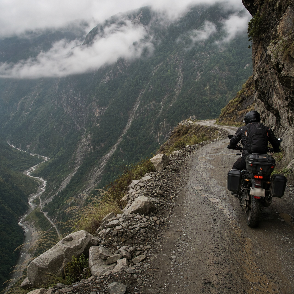
| Arizona | Holbrook, Winslow, Flagstaff, Seligman, Kingman | One of the best states for preserved road |
| California | Needles, Amboy, Pasadena, Santa Monica | Finish day can be slowed by metro traffic |
As a hub article, this page should point readers toward deeper route guides for each state, plus city-specific stopovers such as Chicago, Tulsa, Albuquerque, Flagstaff, and Los Angeles. That structure helps travelers personalize the trip. Someone interested in architecture may spend extra time in Chicago, Tulsa, and downtown Los Angeles. A family with children may prioritize arcades, giant roadside sculptures, and interactive museums. A history-focused traveler may want the Route 66 Museum in Clinton, the National Route 66 Museum in Elk City, and preserved filling stations throughout the corridor.
How Many Days, How Much Money, and Where to Sleep
A realistic Route 66 budget in 2026 depends mostly on pace and comfort level. For a couple driving a fuel-efficient car, expect fuel, lodging, food, attraction tickets, and incidental costs to total roughly $2,800 to $5,500 for a ten-to-fourteen-day trip, excluding airfare or vehicle rental. Budget travelers can come in lower by choosing chain motels outside city centers and limiting paid attractions. Midrange travelers who mix historic motels with standard hotels usually land in the middle. Premium travelers who book iconic restored properties, dine in destination restaurants, and add high-demand detours such as the Grand Canyon or boutique stays in Santa Fe will spend more.
Lodging strategy matters more than many first-time drivers realize. Historic motels are part of the Route 66 experience, but they are not interchangeable with modern chain hotels. Some have small rooms, limited parking, and no elevator, yet they offer the neon, ownership stories, and architectural texture travelers remember. In my experience, the best approach is a hybrid model: book key vintage stays in advance in places like Tucumcari, Williams, or Seligman, then use modern hotels on heavy driving nights. This balances charm with rest. Reserve early for spring and fall weekends, especially in towns with limited inventory or nearby events.
Daily distance should reflect how you like to travel, not just what a mapping app says is possible. Two hundred to two hundred fifty miles per day allows a relaxed experience with photo stops, diners, and a museum or two. Three hundred to four hundred miles is common for travelers trying to finish in under two weeks. More than that is possible, but it turns a heritage route into a marathon. Build in buffer time for old-car museums, bridge walks, tire checks, and simply talking with people. Some of the best Route 66 memories come from owners of cafes, gas stations, and family-run motor courts who explain how their town changed when the interstate arrived.
Vehicles, Safety, and Navigation Mistakes to Avoid
The best vehicle for Route 66 is the one you trust mechanically. A modern sedan, crossover, or SUV is perfectly suitable for nearly the entire trip, and a rental car makes sense for international visitors or anyone without confidence in an older vehicle. Vintage cars are romantic but demand serious preparation. Before departure, inspect tires, brakes, battery age, coolant, belts, hoses, air conditioning, and spare-tire condition. In the desert Southwest, a weak cooling system or worn tire is not a minor inconvenience. It can end the day. If you are driving an electric vehicle, route planning requires extra care because some rural charging gaps still exist, although infrastructure improves every year along major interstate parallels.
Safety on Route 66 is mostly about heat, fatigue, and attention. Heat risk is highest in Texas, New Mexico, Arizona, and inland California, where direct sun and low humidity can dehydrate drivers faster than expected. Keep water in the car, stop before you feel exhausted, and top off fuel when the tank reaches half in remote areas. Night driving can be beautiful in neon towns, but it increases the chance of missing turns on poorly lit historic segments and raises wildlife risk in parts of Arizona and New Mexico. Urban sections require different caution: watch lane guidance closely through Chicago, St. Louis, Albuquerque, and Los Angeles, where one missed turn can cost significant time.
The most common navigation mistake is assuming every town signs the historic route consistently. Some do an excellent job; others are patchy or rely on business-loop signage that appears late. Download offline maps, carry a printed guide, and verify opening hours directly with businesses. Many famous stops are independently operated and can change schedules with little notice. Also remember that not every iconic roadside site is worth a long detour. Prioritize places with strong preservation value, local stories, or unique visual character rather than trying to collect every mural and giant fiberglass figure.
Essential Detours, Themed Stops, and Building Your Perfect Route Guide
The best Route 66 itinerary balances must-see icons with a few carefully chosen detours. The Grand Canyon is the most famous add-on, and from Williams it is an easy extension if you can spare a full day. Petrified Forest National Park is one of the rare national parks that directly incorporates Route 66 history, making it unusually relevant rather than a generic side trip. Santa Fe is another worthwhile divergence because it reflects the route’s earlier alignment and adds art, architecture, and a food scene distinct from the roadside diner culture elsewhere. In Oklahoma, the round barn in Arcadia and POPS combine historic and modern roadside appeal in one efficient stop cluster.
Themed route guides are especially useful under a broader Open Road hub. Readers often search by interest, not geography. Practical subpages should include best Route 66 diners, classic motels, roadside attractions, museums, scenic stretches, EV-friendly planning, family-friendly stops, and the best photo locations for sunrise, sunset, and neon. You can also organize by trip style: seven-day highlights, ten-day balanced itinerary, two-week deep dive, and RV-specific planning. That internal structure helps travelers move from broad inspiration to a realistic schedule without starting over each time.
Route 66 is still the ultimate American road trip because it compresses transport history, regional culture, architecture, food, landscape, and small-town resilience into one coherent drive. In 2026, the smartest Route 66 planning guide is one that respects both the legend and the logistics. Know that the road is fragmented, choose the season carefully, map anchor stops by state, budget honestly, and use layered navigation instead of relying on one app. Book a few memorable historic stays, leave room for unexpected conversations, and focus on quality stops rather than speed alone. If you are building your own Cross-Country USA adventure, use this hub as the starting point, then map your state guides, daily itineraries, and themed stop lists before you turn the key.
Frequently Asked Questions
How long does it take to drive Route 66 in 2026, and what is the ideal itinerary?
A full Route 66 trip usually takes between 2 and 4 weeks, depending on how deeply you want to explore. The historic highway originally stretched about 2,448 miles from Chicago to Santa Monica, but a realistic 2026 Route 66 drive is often longer because travelers use frontage roads, preserved alignments, city bypasses, scenic detours, and side trips to reach iconic attractions. If your goal is simply to say you drove it, 10 to 14 days is possible, but it will feel rushed and you will miss much of what makes Route 66 special. A much better target for most travelers is 16 to 21 days, which gives you time to enjoy classic diners, vintage motels, roadside art, small-town museums, neon districts, and major highlights across Illinois, Missouri, Kansas, Oklahoma, Texas, New Mexico, Arizona, and California.
In practical terms, many travelers break the route into manageable sections of roughly 150 to 250 miles per day. That pace leaves enough time for photography, museum stops, old gas stations, trading posts, scenic pull-offs, and the occasional half-day in larger cities such as Chicago, St. Louis, Oklahoma City, Amarillo, Albuquerque, Flagstaff, and Los Angeles-area endpoints. If you want a balanced plan, consider building in 2 or 3 lighter days along the way, especially in northern Arizona and New Mexico, where side trips and historic segments are especially rewarding. Weather also matters in 2026 planning. Late spring and early fall remain the sweet spots because summer heat in the Southwest can be intense, while winter can bring snow or ice in Illinois, Missouri, New Mexico, and Arizona. For most people, the ideal itinerary is long enough to allow flexibility, because Route 66 is best experienced as a journey of discovery rather than a strict point-to-point sprint.
Can you still drive the original Route 66, or do you need to use modern highways?
You can still drive many preserved and well-marked sections of the original Route 66, but you cannot drive the historic route as one continuous, uninterrupted road from end to end. Since Route 66 was officially removed from the U.S. Highway System in 1985, many segments were absorbed into interstate corridors, renamed as local roads, converted into business loops, or left as frontage roads. That means a successful 2026 Route 66 trip requires a mix of historic alignments and modern highways, especially when original sections have disappeared, become inaccessible, or no longer connect cleanly across state lines.
The good news is that a substantial amount of the old roadway remains drivable, and some of the best parts of the trip are on these preserved stretches. In Illinois and Missouri, you will find classic town-to-town alignments and urban remnants. Kansas offers a very short but beloved section. Oklahoma has one of the richest collections of surviving Route 66 communities, bridges, and roadside architecture. Texas delivers famous Panhandle stops and broad-open driving, while New Mexico and Arizona contain some of the most atmospheric historic stretches, including areas where the old road feels remarkably intact. California combines urban complexity with legendary final-mile symbolism as travelers head toward Santa Monica.
To stay on track, use multiple navigation tools rather than relying on one app alone. Standard GPS apps are excellent for live traffic and rerouting, but they often favor the fastest interstate path instead of the historic alignment. In 2026, the best approach is to combine a dedicated Route 66 guidebook or map set with current digital navigation and state-specific preservation resources. Watch for “Historic Route 66” signs, business loops, and local interpretive markers. It is also smart to verify seasonal road conditions and closures before you go, because construction, flooding, storm damage, and urban redevelopment can affect older segments. In short, yes, you can absolutely drive meaningful portions of the original Route 66, but the most rewarding trip comes from understanding that the journey is a patchwork of surviving history connected by modern travel infrastructure.
What should I budget for a full Route 66 road trip in 2026?
Your 2026 Route 66 budget depends on trip length, travel style, vehicle type, and how many attractions and side trips you include, but a realistic estimate for most travelers is somewhere between moderate and substantial rather than ultra-cheap. Fuel is one of the biggest variables. A full Chicago-to-Santa Monica trip, including detours, often totals 2,500 to 3,500 miles or more. If you are driving a fuel-efficient car, your gasoline cost will be significantly lower than if you are traveling in a large SUV, pickup, camper van, or towing setup. In addition to fuel, lodging typically becomes the largest single category. Travelers who choose budget chain motels can keep costs under control, while those who prioritize restored motor courts, iconic neon motels, boutique stays, and peak-season bookings should expect a noticeably higher nightly rate.
Food is another important line item. Route 66 invites you to stop often, and many people intentionally budget extra for diners, barbecue, pie shops, local cafes, and destination restaurants. Attraction fees may include museums, guided tours, national park or monument detours, and admission to roadside experiences. Parking, tolls in approach cities, souvenirs, car washes, and emergency purchases also add up more than many first-time planners expect. A useful planning framework is to build a daily budget with four buckets: fuel, lodging, meals, and activities, then add a contingency fund for vehicle issues or last-minute changes. Even disciplined planners should reserve extra money for tire problems, windshield chips, weather reroutes, or a night in a more expensive town when options are limited.
For many couples or solo travelers, the best strategy is to book key lodging stops early in popular towns and leave some flexibility elsewhere. Prices can rise around weekends, festivals, and holiday periods, especially at famous Route 66 properties. If you want to balance nostalgia with affordability, alternate splurge nights at classic historic motels with simpler overnight stops in less expensive areas. Also remember that the cheapest trip is not always the best value. Spending a little more on a centrally located, well-reviewed place can save driving time, improve safety, and give you a much better overall experience. A well-planned budget in 2026 should not just cover the miles; it should support the character of the journey.
What is the best way to navigate Route 66 and avoid missing key historic stops?
The best way to navigate Route 66 is to treat navigation as a layered system rather than a single app-driven task. Modern GPS tools are useful, but they are designed to optimize speed and efficiency, which is the opposite of how most people want to experience Route 66. If you simply enter Santa Monica as your destination and follow the fastest route, you will bypass many of the preserved alignments, classic downtowns, old service stations, and photo-worthy landmarks that define the trip. In 2026, smart Route 66 planning means combining a dedicated historic route map or guidebook, current phone navigation, offline downloads, and a prioritized list of must-see stops by state.
Start by identifying your non-negotiable highlights before the trip. These might include restored neon motels, giant roadside sculptures, classic diners, historic bridges, trading posts, museums, ghost towns, or scenic side trips such as the Grand Canyon, Petrified Forest National Park, or Cadillac Ranch. Once you know your priorities, build your route day by day rather than trying to improvise everything on the road. This is especially important in urban areas where multiple alignments exist or where old roads turn into local streets with changing names. In rural stretches, cellular coverage can be inconsistent, so downloading offline maps is essential. Carrying a paper backup map is still wise, particularly for remote sections in the Southwest.
A practical trick is to pin stops in advance in the order you want to see them, then use navigation only for the next segment instead of the whole cross-country drive. That helps you stay on the historic path more often. You should also leave room for unplanned discoveries. Some of the best Route 66 moments happen when you spot a weathered sign, a restored gas pump island, or a tiny museum you had never heard of. Finally, pay attention to local visitor centers and Route 66 associations, because they often provide current information on detours, newly restored attractions, bridge access, or temporary closures. The best navigation plan does not just get you west; it helps you understand where the old road still lives.
What do first-time Route 66 travelers often overlook when planning the trip?
First-time Route 66 travelers often underestimate how much logistics shape the quality of the trip. The biggest oversight is assuming Route 66 works like a modern highway vacation. It does not. This is a historic road trip with fragmented alignments, uneven daily pacing, changing road conditions, and attractions that may keep limited hours. Travelers often focus on the headline distance but overlook practical details such as fuel range in remote areas, whether a motel office closes early, how much time small museums require, or how often they will stop for photos. On Route 66, “just wing it” can work for some stretches, but complete spontaneity can also lead to missed landmarks, sold-out lodging, night driving on unfamiliar roads, or fatigue that